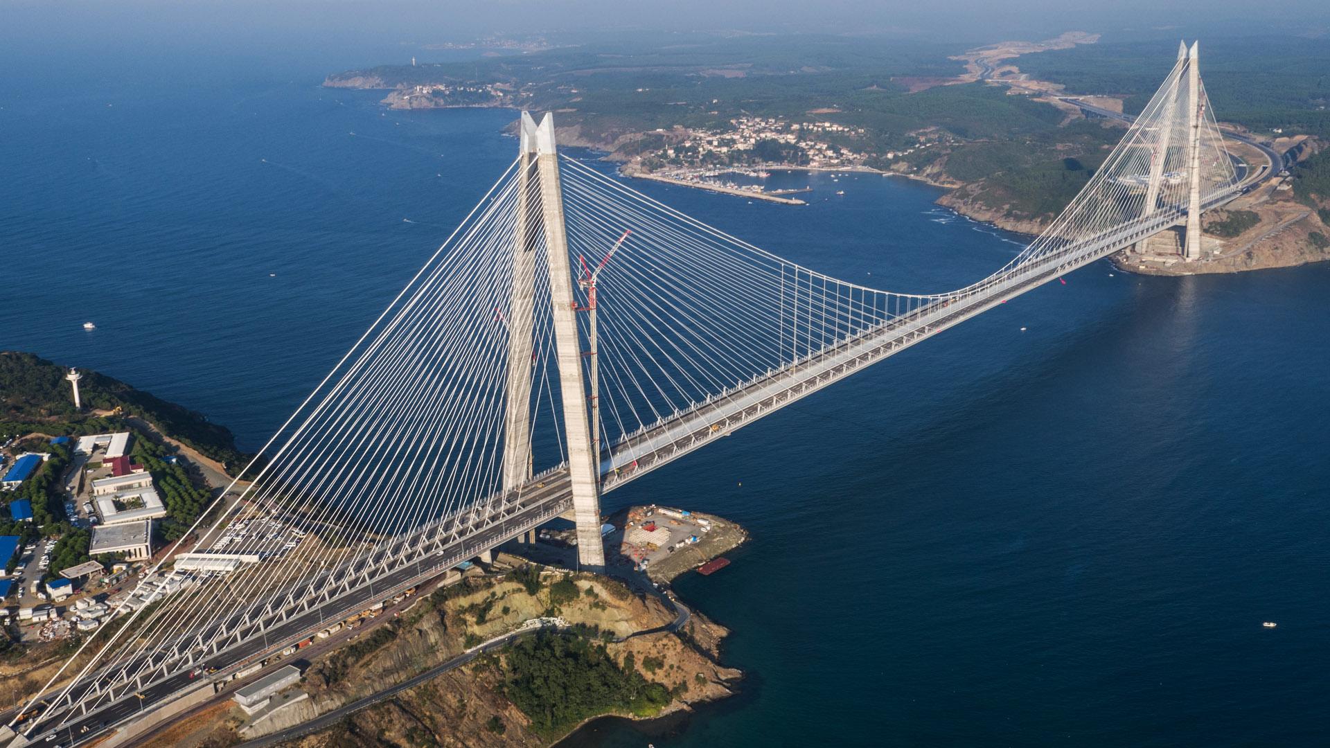
Northern Marmara Motorway and Yavuz Sultan Selim Bridge (Third Bosphorus Bridge)

The construction of 150 km of the Northern Marmara Motorway stretch included the Third Bosphorus Bridge (now named Yavuz Sultan Selim Bridge) the bridge of records:
- the world’s longest and widest hybrid bridge (width of 59 m and main span of 1,408 m);
- the first bridge designed to host an 8-lane highway and a double-track railway all at same level;
- the bridge with the highest tower in the world, above 320 m.
The project has the twin goal of relieving traffic congestion and of creating a corridor that facilitates commercial traffic from and to Greece.
Yavuz Sultan Selim Bridge, a hybrid bridge (both cable-stayed and suspension bridge), is located to the north of the Bosphorus Strait, just before the Black Sea and connect Poyrazkoy, on the Asian side, to Garipce, on the European side.
The load-bearing structure that supports the stays and suspension cables, which the bridge's spans are secured to, comprises two A-shaped pylons, each built using a pair of triangular-section leaning pillars. The two main concrete and steel pylons have their foundations in the earth on the banks of the strait and stand over 320 metres above sea level.
The widest deck in the world comprises two 4-lane carriageways, each separated by a central, twin-track railway corridor, for a total width of 59 metres. The planned transit speed is 120 km/h for road traffic, 160 km/h for passenger trains and 80 km/h for freight trains. The bridge is also accessible to pedestrians thanks to two walkways built along the external edges of the deck, with a width of 2.5 metres.
The central span, 1,408 metres in length, stretches between the two A-shaped pylons and is built of steel with segments measuring 24 metres in length and weighing 840 tons each. While the two side spans, approach viaducts and anchor block are made of concrete.
The following have been used to build the bridge: 241,000 m3 of concrete, 65,000 tons of steel for structure, 31,000 tons of steel for reinforcement, and 29,000 tons for pre-stressed parts, as well as the movement of 897,000 m3 of earth and 32,000 m3 of ground fill.
The design has taken into account the possibility of major-intensity earthquakes occurring given that the site area is affected by the Anatolian fault which runs from east to west along the northern part of Turkey up to the Marmara sea. A preliminary study was carried out in accordance with the guidelines set forth in AASHTO standards (American Association of State Highway and Transportation Officials) for bridge design.
The work was performed using the BOT formula (Build-Operate-Transfer) with regard to design, performance and subsequent management of the project funded on a project finance basis.
The bridge was opened to traffic in August 2016.

Technical data
+ + +
Concrete (m3)
+ + +
Steel (t)
+ + +
Open excavations (m3)
Sustainable KPI
+ + +
People in the catchment area
+ + +
Trees and plants to be planted in 3-5 years
+ + +
Energy driven from renewable sources (during operation phase)